Surveying is the art of determining the relative positions of points on, above or beneath the surface of the earth by means of direct or indirect measurements of distance, direction and elevation. Leveling is a branch of surveying the object of which is to find the elevations of points with respect to a given or assumed datum and to establish points at a given elevation or at different elevations with respect to a given or assumed datum.
The main objectives of surveying can be listed as follows:
a. To determine the relative position of various points above, on, or beneath the surface of the earth.
b. To take the linear measurements and angular measurements between various points.
c. To prepare the plans and maps i.e. for the representation of a measured plot of the area on a horizontal plane.
d. To provide a basis for civil engineering construction works and activities.
2. Principles of Surveying
In general, sur....
Show More
Surveying is the art of determining the relative positions of points on, above or beneath the surface of the earth by means of direct or indirect measurements of distance, direction and elevation. Leveling is a branch of surveying the object of which is to find the elevations of points with respect to a given or assumed datum and to establish points at a given elevation or at different elevations with respect to a given or assumed datum.
The main objectives of surveying can be listed as follows:
a. To determine the relative position of various points above, on, or beneath the surface of the earth.
b. To take the linear measurements and angular measurements between various points.
c. To prepare the plans and maps i.e. for the representation of a measured plot of the area on a horizontal plane.
d. To provide a basis for civil engineering construction works and activities.
2. Principles of Surveying
In general, surveying is based upon a number of principles (or guidelines) which can be listed as follows:
a. Working from Whole to Part
b. Location of Point by Measurement from Two Points of Reference
c. Consistency of Work
d. Independent Check
e. Safeguarding
f. Economy of accuracy and its influence on choice of Equipments
g. Honesty
a. Working from Whole to Part
According to this principle the whole area is first enclosed by main stations. (i.e. controlling stations and main survey lines (i.e. controlling lines). The area is then divided into a number of parts by forming well-condition triangles. The main survey lines are measured with high precision. Then sides of triangles are measured. The purpose of this process of working is to prevent accumulation of error. During this procedure if there is any error in the measurement of any side of triangle then it will not affect the whole work. The error can always be detected and eliminated.
Example: This principle is essential in International Boundary Locating, Property Boundary Locating, etc.
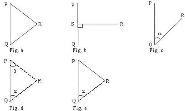
b. Location of Point by Measurement From atleast Two Points of Reference
On the basis of this principle, the relative position of the desired points to be surveyed must be located by taking the measurement from at least two (preferably three) points of reference, such that the position of the reference points has already been fixed previously.
Figure: Location of a Point from Two Reference Points
Let R be the point whose location is to be fixed and P and Q be the two reference points whose positions have already been fixed. The position of the point R can be determined by any one of the above-shown methods in the figure.
c. Consistency of Work
The survey should be consistence (i.e. it should be of same accuracy and precise throughout). If any portion of survey is erogenous then in spite of other remaining part more accuracy that accuracy is of no used as bad quality survey at any part of work ruin the whole survey. But in modern method of survey network adjustment allow for some flexibility in the application of this principle and it is not always necessary for all of a particular stage of survey to be of the same quality but this manipulation depend on the condition and requirement. availability of fund, time and scale of drawing.
d. Independent Check
It says that all the measurement should be checked in such a way that an error will be appeared (i.e. no error is left undetected) before survey is completed. All the measurement should be cross checked by measuring from different points or perspective. (e.g. for a rectangular block measurement the four sides are measured and its diagonal are also measured forming triangles and equating the diagonal to check accuracy. Also Pythagorus theorem and sine law etc. can be used to ascertain the accuracy. Some time measurement from another reference points are also taken to locate the same point by two different measurement.
e. Safeguarding
Since survey can be an expensive process, every sensible precaution should be taken to ensure that the work is not compromised. Safeguarding is concerned with the protection of the work. Observations which are written down in the field must be in a permanent, legible, unambiguous and easily understood from so that others may make good sense of work. Observation and other data should be duplicated at early stage of surveying so that if something happens to the original work the information is not lost.
f. Economy of accuracy and its influence on choice of Equipments
Survey work is usually described as being to a certain standard of accuracy. It is always better to achieve higher degree of precision and accuracy than aimed. The degree of accuracy achieved depends on the instrument used time and effort applied to any survey work. But as we know the expense increase is directly proportional to the accuracy achieved. So the standard accuracy attained in field must be in keeping with the size in of ultimate drawings. (i.e. achieving higher accuracy investing much money on small work is useless) and also selecting much advanced instrument for measuring very small area is also worthless. So selection of instrument and accuracy achieved should be according to work.
g. Honesty
Honesty is essential in booking notes in the field and when plotting and computations in the office. There is nothing to be gained from cooking the survey or altering dimension so that points will tie-in on the drawing. It is utterly unprofessional to betray such trust at each stage on the survey.
 Guest
Guest